The
2011 Hardrock Endurance Run wasn't pretty and it was not the race I had planned on having but I finished and that was the number one goal heading in.
The short version: With support from my amazing wife and family, plus my good friends Greg and Marge, I recorded my first Hardrock 100 finish in a time of 37 hours 38 mins.
See all of Greg's pictures from the race on
Flickr.
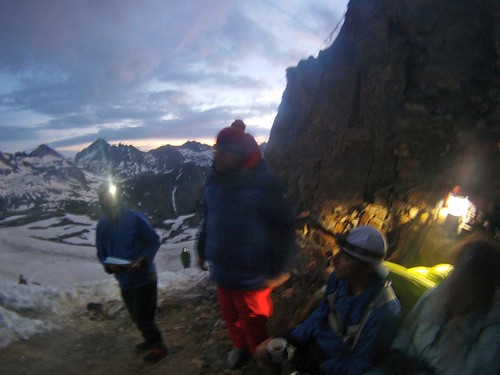
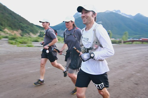
With all the nervous anticipation I had, the race couldn't begin soon enough for me. Once we started up the trail my nerves truly calmed and I broke off into a light jog along with the other 140 runners. The opening few miles were pretty uneventful as we slowly climbed up King Solomon mountain. At the top of Dives Little Giant we were rewarded with our first sunrise of the race and a view to the other side of the canyon. A quick descent of 2,000' to Cunningham at mile 9 and I was able to grab a few supplies and see my family and friends for the last time until mile 42. According to my watch I was about 10 mins ahead of schedule. I took note and dropped my pace just a bit as I caught up to Ryan Cooper.
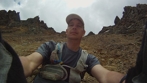
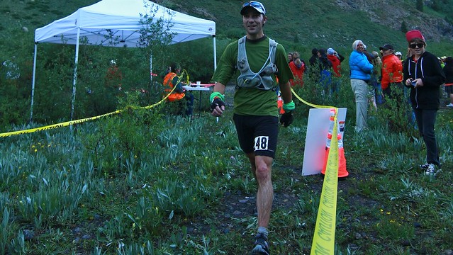 |
| Feeling good at Cunningham Aid Station |
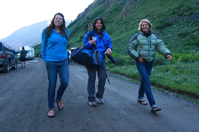 |
| L-R, Betsy, Cheryl and Mindy, Support crew extraordinaire. |
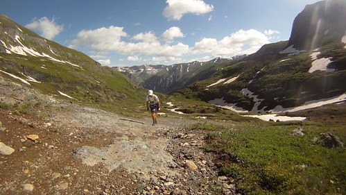
The next 20 miles felt like I was in cruise control as I just made sure I was relaxed and calm. The heat of the day was coming on and I turned my focus to staying on top of my hydration and calories. Soon I was on the cruiser descent into Sherman which reminded me of some of my favorite trails in the Wasatch. I took my time at Sherman (mile 29) and made sure I had plenty of supplies for the long climb up
Handies Peak. The road leading to the trail up Handies is very runnable and like a fool that's what I did. Even though I felt fine the heat was getting more intense and I was becoming dehydrated.
I hit the wall on the first steep pitch in the trees. It suddenly felt as though my head would explode and my stomach would erupt. Over the years I've had plenty of issues with this sort of thing but for some reason it came on much faster this time. Maybe it was the altitude or maybe it was a lack of respect for Hardrock. Either way I knew I was in trouble. I sat down on a log and collected myself. Every runner that passed by offered their help, but I had everything I needed, I just couldn't keep it down. I finally decided to purge my stomach contents and ride the euphoria as long as possible. Immediately I started hiking strongly, fixing my gaze on the 14,000' peak in front of me. Forty-five minutes later I was walking, which quickly turned into a stumble and then I had to sit down again. My thoughts grew dark as I struggled to walk 50 steps at a time. On the upper steep sections I could only manage 10 steps at time except when I was within striking distance of the summit, where I made a big push of 60 steps or so and promptly puked on the peak.
Ben Corrales, a fellow runner and friend from Utah, had passed me just before the peak and wished me well. I could see him running off the peak as I contemplated rolling off the edge. Then I noticed someone walking up the ridge toward me, it was Shane Martin another runner from Utah. He had come down to pace Ben but saw me struggling and came over to help. Shane encouraged me all the way down to Grouse and I was happy for his help but I had made up my mind, I was going to quit.
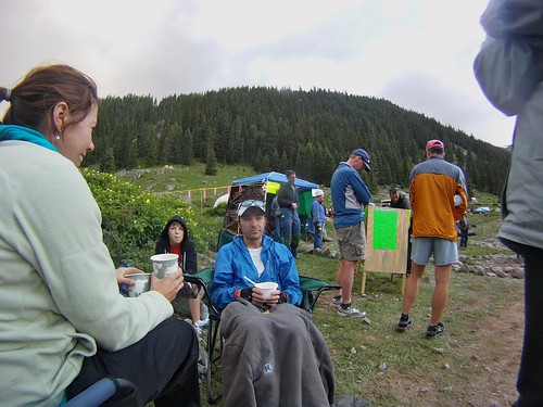 |
| Feeling rather grim at Grouse Gulch aid station |
Initially Betsy and Greg wouldn't even let me talk as they had devised a plan prior to my arrival. Later, they politely listened as I tried to explain how it was hopeless and how the altitude was killing me. But all the while they were pushing soup and broth into my lap and encouraging me to drink it. Slowly I came around and after a little over an hour I stood up to leave and start up the long road toward Engineer Pass. I was still uncertain I could finish, the climb up Handies Peak, as well as the descent, had left me in the darkest place I can ever remember during a race.
This is the reset button I told myself, time for a resurrection. Now I turned my focus to the road directly in front of me and getting to the town of Ouray at mile 56. I could see many runners with their pacers in front of me as the daylight started to fade but I could not see the top of the pass located just below 13,000'. Just then the sky lit up with a bolt of lightning followed by a massive thunderclap, the temperature dropped and the rain began to pour down. I began to feel sorry for myself and dark thoughts started swirling around in my head, then I realized I could be in control if I wanted to be. It was time to rally. I didn't exactly start running but I began to hike with a purpose and soon I was passing other runners. Soon I hit the top of the pass, the wind was howling and I was very cold, but the rain had stopped as I let gravity do it's thing on the way down. The descent to the remote Engineer aid station at mile 49 was more of a controlled fall than a run. All the rain had left the big meadows as slippery as the snow we had passed through at the top. I downed some soup and continued the descent to Ouray, anxious to have Greg's company for the remainder of the race.
The Ouray aid station wasn't exactly a vibrant place at 1am, so I downed some more soup and hit the trail with Greg. On the climb up to Box Canyon we had a bat dive bomb us a couple of times in the tunnel, flying directly into the beam of the headlamp which was really weird. I ran small sections of the Camp Bird road on the way to Governors Basin but mostly stuck with a steady hike as I was well aware of what was waiting for us after the Governor Basin aid station. More soup at the aid station and we began the steep hike up to Virginius Pass, site of the most unique aid station in the race, Kroger's Canteen.
 |
| Roch Horton in the center, I'm sitting on the right at Kroger's Canteen |
Greg and I passed a couple of runners as we made our way into the upper basin. I was feeling good as we hit the first big patches of snow and noticed the dark outline of the mountains against the star filled sky. The basin was so full of snow that I had a hard time recognizing the three distinct pitches leading to the pass. Finally, after climbing the second pitch the pass came into view. The scene resembled something out of a mountaineering film with all the snow and headlamps dotting the way up. Then the sun started to just come up and provide just enough light to illuminate the entire basin. The scene was very surreal. Next thing I knew I was sitting next to Betsy Nye enjoying a pirogi given to me by the infamous Roch Horton. "4,500 feet down to Telluride, don't trash your quads and enjoy the rest of your run" were the words I left with from Roch as I skied down the scree field off the pass.
The descent to Telluride was smooth as I passed a few more runners. I was grateful that I could still run downhill since the ups were feeling really slow to me. Betsy was waiting for us in Telluride at mile 73 and I took the opportunity to change my shirt and socks. I bid her farewell to start the big climb up the re-routed section of the course into Bridal Veil basin. Before race day I scoffed at the extra 2 miles this section would add on to the race, but I wasn't scoffing at the extra distance now. Once we got up in to the basin we could see the true size of it and it just kept going and going. This prompted me to start a new game called "Guess that pass". From here on Greg and I would guess which pass it was we would be going over. I usually guessed the closest one and I'm quite sure I was always wrong.
 |
| Slowly making my way up into Bridal Veil Basin |
 |
| Impromptu aid station stop in Bridal Veil Basin |
Oscar's Pass was the name of our next high point and I remember
Karl Meltzer telling me how awful the top of the descent to Chapman was. Karl was right. The rocky descent was an ankle breaker and I took my time until the rocks relented and I could run again.
 |
| Heading off Oscar's Pass on the rocky descent, Grant Swamp Pass in the distance |
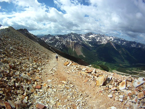
Next up we pulled into Chapman at mile 82 where I chatted with Ryan Burch and his wife while they waited for their friend. Greg and I stocked up for the long haul up Grant Swamp Pass and down the KT aid station at mile 89. Chapman represented the beginning of the end. There were now less than 20 miles to the finish. The climb up to Grant Swamp became a real slog. By the time I hit the final pitch I was moving pretty slowly, as I was most the time above 12,000'. The lack of oxygen started giving me low grade headaches and made me feel like my energy was really low. Thankfully my legs still felt good, but I just could not summon a consistent hike out of them.
 |
| Greg's self portrait with Grant Swamp Pass in the background |
 |
| Me on the descent side of Grant Swamp, Island Lake in the background |
The final pitch up to Grant Swamp Pass is just about the cruelest thing I have ever seen in a race. Each footstep would sink into the scree and if it didn't slide backward I would celebrate. I was completely stoked to see Island Lake on the other side and told Greg how he needed to take a picture. "No time" he replied and pointed to the dark clouds building behind Grant Peak. I began to shuffle down off the pass and felt the first couple of raindrops. I stopped to put on my jacket and just then the air around us sizzled with a the crack of a lightning bolt. I turned and ran faster than I ever thought was possible, looking for the trees. The lightning and hail kept me motivated as I was breathing harder than I had in nearly 24 hours.
Finally we came to the bottom edge of the trees and the last bit of cover. I knew the Kamm Traverse was very exposed and with all the lightning I told Greg I wanted to wait it out. He agreed, but after 10 minutes or so we were shivering uncontrollably and decided we needed to run to keep hypothermia at bay. A mile or so later we were at the KT aid station as the rain finally stopped. Much to my surprise Ben and Shane were there warming up so I suggested we tackle the last 11 miles together. Everyone agreed, and after downing the best soup of the whole race we were off.
Almost immediately we had to cross the upper Mineral Creek which is normally quite a bit lower. However, with the recent storm and high snow it was waist deep and I struggled to keep my feet underneath me. The next climb went well and I felt like I was finally full of energy again so I pushed a little harder to get to the pass. I should have known better. We still had a cross-country route to climb up to a ridge that could not be seen. Again, cruel. I finally topped out and just kept it moving as we made note of another storm bearing down on us.
First the rain came down followed by...you guessed it; the hail stones. Once again I was descending much faster than I thought I was capable of. My quads were fried. The previous descent had sapped all my strength. I focused on keeping it upright and looking for the trees where the Putnam aid station was located.
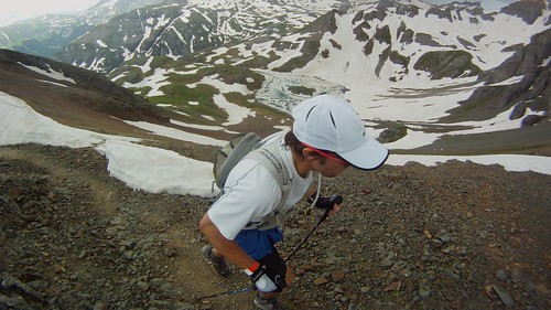
 |
| On the final ascent of the race |
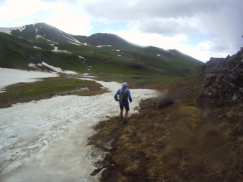 |
| The rain starts coming down on the descent to Putnam aid station |
Finally a big yellow tent appeared and we climbed inside seeking shelter from the hailstorm outside. Three aid station volunteers along with Blake Wood and his daughter were inside. The four of us joined them as we waited for the storm to relent. Soon four more joined us inside. I was growing frustrated since we were so close but I was unwilling to risk hypothermia for a finish. About 30 minutes after reaching the aid station the hail finally turned to rain and we left.
We made quick work of the descent as we picked up Brian Beckstead who had hiked up to meet us (another Utah runner who had paced Ben earlier in the race). Finally we arrived at the final river crossing. First I watched Ben get across Mineral Creek then I followed. I was a bit nervous but managed to keep my feet underneath me as the swift current pulled at my legs. Ben and I took off running since we knew Greg and Shane would catch up to us. I fell into a trance and tried to fight off the emotion that was welling up inside of me.
 |
| The final approach to the finish, L-R Shane, Ben, Christian |
The final mile or so was a blur as my mind flashed over the previous 37 hours. Ben and I ran up the final chute together and kissed the fabled rock. And just like that it was over. The longest (time wise) and hardest journey I've ever done. Out of 140 starters there were only 80 finishers, one of the highest attrition rates ever for the race. No doubt about it, I would not have finished without the support of my ever supportive wife Betsy, my kids Mason and Paige, as well as my good friend and pacer Greg Norrander.